Fern Ridge Lake
11 mi northwest · US Army Corps of Engineers
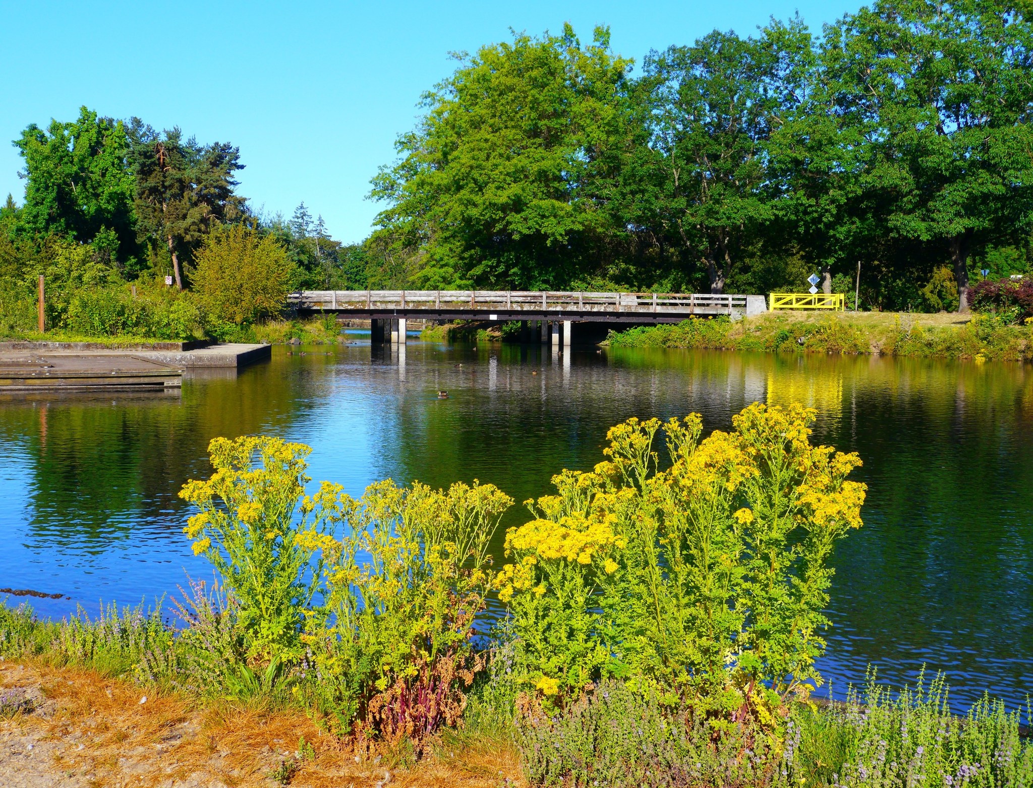
Fern Ridge Lake, a popular recreation area for sailing, power boating and water skiing, is just 12 miles from downtown Eugene.
Outdoors
Lakes, rivers and recreation areas near Eugene where fishing is allowed, closest first.
Good to know: Anyone 16 or older generally needs a state fishing license; seasons, limits and special rules vary by water. Oregon license information ↗
11 mi northwest · US Army Corps of Engineers
Fern Ridge Lake, a popular recreation area for sailing, power boating and water skiing, is just 12 miles from downtown Eugene.
17 mi northeast · Bureau of Land Management
Looking for that motorized trail experience to enjoy with family and friends? The Shotgun OHV System offers a mix of challenges, scenic views, technical features, and amenities to satisfy the OHV enthusiast.
19 mi south · Bureau of Land Management
This 14-mile, paved, multi-use National Recreation Trail follows the route of the now-abandoned Oregon Pacific & Eastern Railroad line, along the scenic shores of the Row (rhymes with "cow") River and Dorena Reservoir.
Map of 18 places loads as you scroll.
Fern Ridge Lake, a popular recreation area for sailing, power boating and water skiing, is just 12 miles from downtown Eugene.
Looking for that motorized trail experience to enjoy with family and friends? The Shotgun OHV System offers a mix of challenges, scenic views, technical features, and amenities to satisfy the OHV enthusiast.
This 14-mile, paved, multi-use National Recreation Trail follows the route of the now-abandoned Oregon Pacific & Eastern Railroad line, along the scenic shores of the Row (rhymes with "cow") River and Dorena Reservoir.
Schwarz Campground is located below Dorena Lake in Oregon's Southern Willamette Valley. The campground is approximately five miles from the city of Cottage Grove.
The lake is located in rolling, partially wooded hill country. Its three parks offer boating, swimming, sailing, fishing and water skiing. Schwarz park located downstream of the dam, offers overnight camping for families and groups.
The lake and its shoreline set in the gently rolling hills of the Willamette Valley, is used for boating, swimming, water skiing, fishing, picnicking and camping.
This site, sometimes referred to as Horton Lake, Hult Marsh, Hult Reservoir, or Mill Pond, was developed in the early 1900s for logging operations.
Pine Meadows Campground is located on Cottage Grove Lake in Oregon's southern Willamette Valley.
The natural bedrock slide at Lake Creek Falls is very popular and ideal for a hot summer day! A series of low cascades carved in the bedrock within a narrow gorge create this geological wonder that spills into Triangle Lake.
Reserve a site at Alsea Falls on recreation.gov or pay when you arrive for non-reserved campsites using the Recreation.gov Mobile App . You must download before you reach the site since there is no cell reception in the drainage.
Bedrock is located in a dynamic landscape setting shaped by fire, this 22 site camground is situated on a terrace above Fall Creek where the hillsides surrounding the camp offer an impressive fireweed bloom display during the summer…
Located outside the City of Corvallis, just off of Highway 99, William L. Finley offers unique wildlife viewing opportunities for the whole family!
Rujada Campground is located 21 miles east of Cottage Grove (45 minutes from Eugene) on a riverside terrace above Layng Creek.
Black Canyon Campground in Oregon rests next to the Middle Fork of the Willamette River. This scenic campground is heavily shaded by towering hemlock, cedar and Douglas fir. Fishing and kayaking are a popular pastimes.
Located in the beautiful Willamette Valley on the South Santiam River, Foster Lake provides boating, swimming and picnicking opportunities. The Foster Dam and Lake regulates the flow from the nearby Green Peter dam.
Vincent Creek is a small campground located along Smith River at the mouth of Vincent Creek. Camp or picnic at the site with your family and enjoy a small swimming hole under towering Douglas-fir trees.
Oregon’s Smith River forms in the Coast Range and flows about 50 miles west, emptying into the Pacific Ocean just north of Reedsport, Oregon. This site offers camping right next to the river, just above the falls.
Fawn Creek Campground is a primitive two site campground along the river with a small boat ramp providing access to the confluence of Fawn Creek and Smith River.
Distances are straight-line miles from downtown Eugene. Listings come from Recreation.gov’s federal recreation database; check each official page for hours, fees, fire restrictions and closures before you go.

THINGS TO DO · YOUTUBE SHORT
An activity Short shared by Traveling Spud.
Watch on YouTube ↗
THINGS TO DO · YOUTUBE SHORT
An activity Short shared by The Boutique Adventurer.
Watch on YouTube ↗


Fern Ridge Lake (US Army Corps of Engineers), about 11 miles northwest of Eugene as the crow flies. Next are Shotgun Creek OHV Staging Area (17 mi) and Row River Trail (19 mi).
Yes, anglers 16 and older generally need a Oregon fishing license from the state wildlife agency. Rules, seasons and limits vary by water.
Federal agencies including Bureau of Land Management, US Army Corps of Engineers, USDA Forest Service. Each listing links to its official page for hours, fees, closures and current conditions.